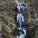
 The Delaware Water Gap in northern New Jersey holds a couple of waterfalls that will never cease to amaze. Located just outside the little town of Walpack, Buttermilk Falls, the more popular of the two, is the highest waterfall in New Jersey. Following the trail 1.9mi will allow you enjoy a hike on a portion of the classic Appalachian Trail (http://www.nps.gov/dewa/planyourvisit/hikes-at-sunfish-nj.htm). The requisite climb of the stairs to the top of the falls is a must. When you have had you fill of the well traveled path and all the crowds it attracts, head down the road to Silver Spray Falls to explore on your own.
 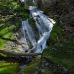 Located over a half mile to the south of Buttermilk Falls, Silver Spray Falls yields views that are just as stunning (if not better), but without the crowds. However, little seems to be known about these falls, including the from the locals. A stop at the local deli will get you directions to Silver Spray Farm, but mention the falls and you may be told nothing of the sort exists. Many people don't realize that many of our greatest treasures lie where few people have ventured. Park at the abandoned Farm and head North on Mountain Road about 500ft. Once past the house head east and make your way back towards the creek. Stay next to the creek and enjoy one of the sights in solitude. You may want to pack a lunch as it will surely take you longer then expected, after all, there are so many pictures to be taken.
Quick Info:
Location: Deleware Water Gap NRA, NJ, USA Permits: None Distance: Varies Difficulty: Varies from 2-5 http://www.nps.gov/dewa/
[geo_mashup_map]
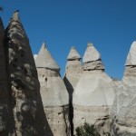 Created millions of years ago by volcanic activity, the tent rocks are a wonder of unique geological formations. Today this land can be explored by way of two short and relatively easy trails. Cave Loop is the easier of the two, and is a 1.2 mile loop that take you near these natural marvels as well as a cave used by the Pueblo Indians. The other trail, Canyon Trail, winds it's way through slot canyons to the top of the plateau overlooking the tent rocks. It's about 1.5 miles long with moderate grades and exposure. From the top
 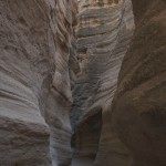 you can enjoy stunning views of not only the Sangre de Cristo, Sandia, and Jamez mountains, the Rio Grande Valley as well as the tent rocks. No overnight trips are allowed at the monument but the tent rocks make a nice day trip.
Getting There
The tent rocks are located approx. 45 miles southwest of Santa Fe. From I-25 take Exit 259 (Santa Domingo/Cochiti Lake Recreation Area). Follow NM-22 to Kasha-Katuwe Tent Rocks National Monument to a water tower painted like a drum (Tribal Route 92). After paying the five dollar private vehicles entrance fee proceed up the gravel road to the parking area.Quick Info
Location: Kasha Katuwe Tent Rocks National Monument, New Mexico, USA Fee: $5/car Difficulty: 3 http://www.blm.gov/nm/st/en/prog/recreation/rio_puerco/kasha_katuwe_tent_rocks.html [geo_mashup_map]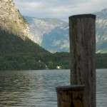 Although it's true that a trip to Austria is not complete without spending a day or two in the capitol city of Vienna, any self-respecting adventure traveler will want to shed themselves of the city and get to the magnificent Austrian Alps in the West and South of the country. Flights can also be taken to Salzburg to the west, however there are a few places in Vienna that you may like to stop and see. Two such spots are Cafe Demel and Cafe Sacher (in the Hotel Sacher). The Cafe Demel is a great spot if you need to stock up on maps for you trip. Directly the street is the famous mapmakers Freytag & Berndt's bookstore. There you can find many maps that cover different areas and different scales. Keep in mind though that the process of choosing a map can be a little tricky unless your German is up to speed. The staff will help you find what you are looking for. You should stock up on beta and reading material before you get there though, since there are few English books at Freytag & Berndt's. There are a few good places for lunch if you have a little more time. 1516 Brewery
 at Krugerstraße 18 serves up a decent list of house brewed beers, including some by guest brewers that may be recognized by a micro brew connoisseur. Across the street Grappino serves up great Italian food in a quieter environment. If pizza is your game, try Al Cavallino at Dorotheergasse 19. Of course there is plenty more to do in Vienna but there have been countless guidebooks written on the subject, so there's not need to re-hash it all in this article. Two such resources are the Rough Guide to Austria (Buy) and Loney Planet Guide to Austria (Buy). Although a Vienna specific book is published by both publishers, the Austria books include most of the content and covers much more. Whether you have had your fill of Vienna or decided to skip it entirely, when you are ready to head to the Alps go to the the Westbahnhof train station. OBB runs a very efficient operation that can get you to any town of a reasonable size from there, this is your ticket to the real adventure.
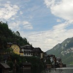 From Vienna it's a two and half hour to the transfer at Attnang-Puchheim where your train will take you south to the Salzkammergut area of Austria. Although this area is not home to the grand Alps that we often associate with the Austrian Alps, the cliffs rising directly out of glacial lakes makes this area an adventure seekers dream. The draw of this region attracts events like the Red Bull X-Alps competition. This competition is held every year and requires participants to travel 850KM from Krippenstein to Monaco. Even if you don't have the time for a trek across half of Europe there is still plenty to do. Each summer the Salzkammergut Mountain Bike Trophy race is held starting and finishing in Bad Goisern. If you can't make it for the race or just want a little more space you, can ride each course. They range from 14.7 mi to 129.7 mi. so make sure you're biking legs are in shape. Each course is included in the map on this site, but individual Google Earth and GPS files are available from http://www.salzkammergut-trophy.at/show_page.php?pid=284. If you would like to explore more biking tours, you can download them from http://bike-gps.idrz.de/.
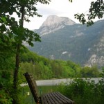 Although mountain biking may seem like the permier activity, in reality there is much more to do. SCUBA diving oppertunities are all around, including the gorgeous Hallstatt lake. On the the shore of Hallstatt lake is the town of Hallstatt. Although it has become rather touristy lately, this town is worth the trip as the view of the town situated on both the shore of the lake and the base of a cliff is simply stunning. From here you can charter a guide to take you onto the lake for a great day of diving (http://www.hallstatt.net/publisher/articleview/action/view/frmArticleID/121/?lang=en-iso-8859-15). If you would rather a view from above there are numerous options for that as well. For those not willing to go over the edge there are cable cars that offer some 'life list' views, while those craving a loftier feeling can take a para-gliding ride with a licensed instructor (http://www.aufwind.at/aufwind/content/TxtB_1664/view). Other great adventures include ice caves, innumerable hiking & biking trails, and plenty of kayaking or conoeing trips. Regardless of how you plan your travel, there is plenty of sights to see.

Although it may lack the high end wines of California's Napa Valley or Sonoma and it definitely lacks the popularity of the same, Long Island vineyards offer a nice escape to those in the Northeast. There are about thirty wineries on Long Island and many are in close proximity to one another making a day of vineyard hopping rather enjoyable. As each person's taste's are different and each vineyard has it bad and good years I will reserve judgment on any specific wine or vineyard. Instead, judge for yourself. Gather a few friends, rent a limo for the day from one of the many limo companies in the area and have yourself a ball. Many of the limo companies offer vineyard tastings arranged by them but simply renting the limo and doing the tasting on your own yields a more relaxed day. This frees you up to move at your own pace. Bring lunch and many of the wineries have tables you can sit and eat at.
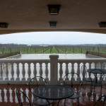
The best time to head to eastern Long Island is in April. Not only do you not run into the huge crowds that gather during the summer, but you will have to opportunity to do some barrel tastings. Offered at many wineries on Saturdays during the month you can head to the barrel room and taste the wines as they age in the barrels, before bottling takes place. Many of these tastings are done with the owner or senior wine maker and allow you not only to see and taste the wine in it's most naked form but to ask questions about the wine and the

wine making process of those most knowledgeable. So, for less expensive trips with considerably smaller crowds head to the east end of Long Island for some spring wine tasting.
Quick Info
Location:Long Island, New York, USA Price: Varies (Limo approx. $100/hr, tasting range from $5 to $10 http://www.liwines.com
I first came across a description of the Trooper Traverse in an article -- aptly titled "Lost Trails" -- published in the June 2007 issue of Backpacker magazine (Subscribe). The Trooper Traverse is a spectacular journey that is rich with history and likely to make a lasting impression on even the least sentimental among us. This 30 mile one-way trip features some of the most pristine high country in the United States. Contact with other humans (on or off trail) is quite limited, as roads and other trails are few and far between. But, if you're up for the challenge, this trip will reward you many times over.
History
The Trooper Traverse was first accomplished in the winter of 1944 by members of the 10th Mountain Division who were headed to Europe to fight in WWII. Some of these soldiers never came home; others went on to become leaders in the wilderness community. The founders of both the National Outdoor Leadership School and Outward Bound completed the original Trooper Traverse. For a more in-depth history of the trail and its original participants, see Lou Dawson's article on Wild Snow.The Way
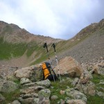
The Backpacker article lacks some information that would be useful for proper planning. For example, Backpacker states there is no technical climbing. While this may be true 'technically' speaking, inexperienced packers may find the descent from Williams Mountain to be a bit intimidating. Also bear in mind that you'll be above 11,000 ft nearly the entire way -- another factor that may be intimidating for less experienced packers. While these details should not be deal-breakers in your decision whether or not to attempt the Traverse, you should be aware that the third and fourth day may go more slowly than you than would typically expect. Plan a solid four days for this trek. Intrigued? Start your planning now for next summer to ensure you have time to properly prepare.
Transportation
Arrange for some sort of pick-up in Aspen. You can either leave a vehicle at the trailhead in Aspen (GPS: 39°12.349'N 106°47.888'W), or better yet: arrange for someone to take you back to Leadville when you’re finished. If you do choose to leave a vehicle in Aspen: from Main St. and Mill St. in Aspen, head North on North Mill St. for .3mi., bear left onto Red Mountain Rd. for 1.1mi., make a sharp left to stay on Red Mountain Rd. and proceed .3mi., make a sharp right to stay on Red Mountain Road and proceed 1.3 miles to the parking area.
To get to the Leadville trailhead, take CO-82 east over Independence Pass from Aspen, head north on US-24 for 11mi. to the turnoff for the Leadville Fish Hatchery, CO-300 for .8mi., turn Left CR-11 for 1.2mi. and make a right onto Halfmoon Road. Follow this road 4.4mi. to the Mt. Massive/Mt. Elbert parking lots. Depending on your vehicle, you may want to park here (GPS: 39°9.103'N 106°25.159'W). High Clearance 4x4 vehicles should be able to make it across Halfmoon Creek and park further up the trail (GPS: 39°9.247'N 106°27.844'N).
Day One
Once parked and ready to go, head up Halfmoon Rd. The first day camp is fairly close to the trailhead, but keep in mind the backpacking version is shorter than the original ski trip of 40mi. That said, you may want to progress past the original campsites on the first two or three days to prevent the last day from turning into a late hike. Remember, the pack trail on the last day that is shown on some maps, no longer extends as far up as shown. The path to night one camp (GPS: 39°9.122'N 106°28.712'W) is not far up the road, but continue on into early evening to get a jump on day two.Day Two
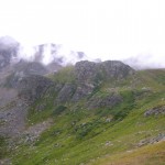
On day two, head back to the end of the valley to Darling Pass (GPS: 39°8.637'N 106°31.207'W) this is a moderate hike, but take your time and enjoy the views over your shoulder as you climb above tree-line. Plan to get a fairly early start as thunderstorms are common in the afternoon. At the top of Darling Pass take a moment to enjoy the view of the meadow valley before you and know that you are one of the fortunate few who have ever had the opportunity to enjoy this view. In June and July (during the height of the wildflower bloom) the views in this valley are absolutely spectacular. Continue down into the valley toward the small stream drainage. This leads to a pack trail that will lead your ascent to the top of the Continental Divide. Don't get too attached to the idea of being on a trail, however, when you reach the crest of the first little hill, you'll want to veer to the North and proceed up the North side of the valley. A nice shelf near the top of the valley served as the original day two camp. But, if weather permits, continue up to the pass near the divide to camp on the ledge overlooking the valley (GPS: 39°9.289'N 106°33.337'W). There are few campsites in the world that rival the views from here. The wind in this location can be a drawback, but when all's said and done, the view is more than worth it.
Day Three
Get an early start on day three -- take in some breakfast while you enjoy the sunrise over Darling Pass and and watch the morning sunlight fill the valley below. When you're ready to hit the trail, head up the last couple hundred feet to the top of the Continental Divide (GPS: 39°9.389'N 106°33.544'W) and pause for a moment to appreciate crossing this epic boundary. While thousands of people every year cross the divide, very few cross it in such an impressive manner. Once across the divide, traverse southwest along the boulder field. Keep your eyes out for mountain goats and the elusive bighorn sheep. As you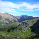
descend the pass, you will see Lost Man Lake far to South. Look for the pack trail that winds down the valley (it follows along the stream leading down from the Lost Man Lake). When you find the "T" (GPS: 39°10.077'N 106°35.534'W), proceed straight though onto what appears to be a foot trail - but quickly fades into vegetation. Other than the altitude and grade, this terrain is fairly easy to traverse.
Extreme Caution
Continue up the ridge to the Southwest to the top of the Williams Mountains. Near the top of this ridge is a great place to drop your pack and take a break, as the descent on the west side (GPS: 39°10.316'N 106°36.960'W) is extremely challenging. This is the most difficult part of the trip. It’s very important to take your time on this descent. The slope is extremely steep and littered with large boulders and medium to small sized scree. If that wasn’t enough to inspire extreme caution, this is where the pack trail to the end should exist but - See note below in 'Planning' section - it doesn't. Proceed down the valley towards Aspen, following any game trails you find heading westerly, and find a nice place to camp alongside the creek for your final night.Day Four
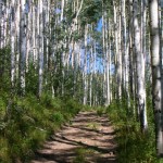
On your final morning continue down Hunter Creek Valley towards Aspen. Keep an eye out for the trail keeping in mind that at many points it fades to vegetation and possibly swamp (during wetter years). Eventually you will pick up a solid trail. Continue on the trail (#35) until you come out on an old 4x4 road. Follow this road until you reach the intersection for Woody Creek. Stay left at this intersection, continuing down the valley. Follow the main trail past several other forks. You'll end up skirting the edges of a very large summit - it's very steep so watch your step. Continue down the large 4x4 road to Red Mountain Rd. where your car should be located. Finally, head down to Aspen for a well-deserved beverage and an early dinner!
Planning
For route planning use the National Geographic Trail Illustrated 127 Aspen/Independence Pass ({amazon}B000YU8S8M Buy{/amazon}). This map shows the pack trail in Hunter Creek Valley more accurately than the USGS Quadrangle. And almost as if it were made for this route, it conveniently covers Leadville to Aspen. Plus, it is waterproof and tear resistant so it should hold up nicely for the duration of the trip. Note that the pack trail shown in the Hunter Creek Valley doesn't extend as far up the valley as the USGS 24K Topo maps show.Summary
Keep in mind however that the entire route is at high altitude and of course, is quite remote. Proper planning is the key to not only enjoying the trip but being safe in doing so. Keep and eye on the weather before you head out and during the trip. Four full days is sufficient for the trip but could be done in three for fast packers and five for those who want to take a little extra time. The Trooper Traverse is a challenging route that will put you in the backcountry that is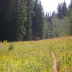
as pristine now as it was in 1944. Add to that the knowledge that you're following in the footsteps of some truly brave men, and I think you'll find this to be an experience of a lifetime.
Quick Info
Location: Hunter Fryingpan Wilderness, Colorado, USA Permits: None Distance: 30.8 miles Difficulty (1-10): 8 Beta: Trail Illustrated 127 (Buy) Backpacker Magazine, June 2007 [geo_mashup_map]
Located about an hour south of Albuquerque on BLM land, San Lorenzo Canyon offers a short & easy trip for those looking to backpack with someone inexperienced, children, or anyone just looking for a simple trip. There is only about a mile and a half of canyon before the Sevilleta National Wildlife Refuge (which is off limits without permission), so the canyon offers the possibility of a Friday night hike in allowing almost two full days of day hiking. Campsites with a nice view can be found with an eye upward and the willingness to do a little light scrambling. Water is tough to find so plan accordingly during the drier seasons.
Directions:
Take exit 156 off I-25 for Lemitar and head to the west to the service station to stock up on beef jerky and water. When your finished shopping take the service road North that runs parallel to I-25, on the West side approx. 5 miles. When the road makes a sharp turn to the East take the left on a maintained dirt road. In approx. 2 miles you will see a sign on the right to San Lorenzo Canyon. If you are in a four wheel drive take this road as far as you see fit (if you are so inclined you can drive all the way up the canyon). If you are in a two wheel drive back up to one of the dirt roads and head up a little ways until you find suitable parking. Wherever you park, just head West in the wash to the mouth of the canyon.
Quick Info
Location: Aevilleta National Wildlife Refuge, New Mexico, USA Permits: None Distance: 1.5 miles one-way Difficulty (1-10): 2 Beta: http://www.explorenm.com/hikes/SanLorenzo/ http://www.blm.gov/nm/st/en/prog/recreation/socorro/san_lorenzo_canyon.html [geo_mashup_map]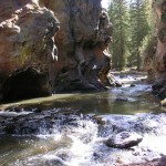
If barren desert is what comes to mind when you think of New Mexico, think again. In the Jemez mountains about 45 minutes from Santa Fe (in the National Forest of the same name) runs the Jemez River. With tons of trails in the area, the hiking and backpacking opportunities are almost endless. Add to that the Jemez Falls and the McCauley Hot Springs and the Jemez river makes for great weekend outings with the kids. Keep in mind the area is quite popular and thus solitude can be a little tricky.
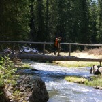
If nothing else you can find a secluded campsite by being a little adventuresome and heading off trail. There are also some sport climbing routes in the area along the river if that's your sport. The scenery while driving on US 4 will leave you speechless as well, particularly to the west. After a nice weekend head to Cafe Pasquals in Santa Fe for an absolutely divine brunch.
Quick Info
Location: Santa Fe National Forest, New Mexico, USA Permits: None Distance: Many variations Difficulty (1-10): 3 http://www.fs.fed.us/r3/sfe/index.html [geo_mashup_map]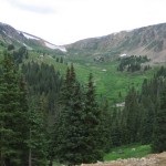 Breckenridge, Colorado is famous for being one of the best skiing/snowboarding destinations in North America. The mountains surrounding Breckenridge offer some of the best snow in the state, and the scenery is second to none. This popular winter destination is well served by the many summer activities available in Breckenridge. From alpine slides to real Colorado mountain biking, Breckenridge has something to offer everyone. One of my passions is scenic off roading, so last September, we decided to head to Breckenridge and find a few off road trails. We went with 2 FJ Cruiser's, a Jeep Wrangler, and a Chevy Avalanche for the run. We started off simple and decided to get Boreas Pass & Georgia Pass out of the way.
 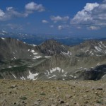 Boreas Pass is a very easy dirt road, any car will be just fine on this pass during good weather. The south side of Georgia Pass is about the same, but once we arrived at the top we found a very challenging trail. After a quick jaunt up Glacier Ridge, we headed down the north side of Georgia Pass (Rd 355). It became exciting right away, with a rather large rock blocking the trail. The Jeep decided to take the more difficult line, but the rest of us took the easier route around the rock. We crawled our way down the mountain, trying to say on the right trail.
 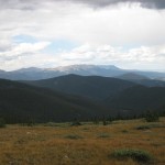 We eventually made it down to Swan River just in time for the rain to begin. We headed back to our little campsite (well off the beaten path, GPS 39.5354, -105.9006), packed up, and headed for home. Although we didn't get to hit all the trails in the area, it was a wonderful trip! If you're interested in experiencing the Breckenridge area by 4x4, I've put together a Google Earth layer of the major off-road trails.
Outfitters
There's only one Jeep Rental place in the Breckenridge area: Mountain High Jeep Rentals. If you're visiting from elsewhere in Colorado, there are many other Jeep Rentalservices.
Where to Stay
Breckenridge & the surrounding area is a popular tourist area, so you'll have no problems finding a place to stay. There are dozens of great hotels, condos, and house rentals available. Make your reservations as far in advance as possible to get the best rate and the best room.
Food in Breckenridge
 While we brought most of our food to the campsite with us on this trip, Breckenridge has plenty of great places to eat. There’s a little known pizza place on the north side of town, in the City Market plaza called Windy City Pizza. If you’re on the main drag, we’ve had really good luck with the Bubba Gump Shrimp Co., and Downstairs At Erics. Don’t forget the infamous Breckenridge Breweryif you’re a microbrew fan.
Quick Info
Location: Breckenridge, Colorado, USA Season: Spring to Fall Permits: None Distance: Varies Difficulty (1-10): Varies Beta: Guide to Colorado Backroads (Buy) [geo_mashup_map]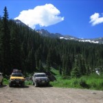 Wow pretty much sums it up. The First Annual FJ Summit was held in Ouray, CO last July. It all started when several people from a FJ Cruiser Forums website started brainstorming about a meeting of FJ Cruiser owners nationwide. It wasn't too long before everyone voted on the location for this first event, and Ouray was chosen. Why Ouray? Well, if you haven't been there you don't know what you're missing. The 'Switzerland of America' is a beautiful small town in southwestern Colorado surrounded by the San Juan mountains. What makes Ouray so special to the off road community is the trails. Hundreds of miles of the most scenic, breathtaking, and awe inspiring off road trails in the country. This is not just a visitor guide bullet, the beauty can't be described with just words.
Getting There
My wife, Angie & I met Kent & John (from London, Ontario, Canada), and our friend Stan & family (from Highlands Ranch, CO) for the drive up. This is my Quick Info Box Content Welcome!We took the scenic route through the mountains from Colorado Springs. We first headed out US-24, over Wilkerson Pass and down to beautiful Buena Vista & the Collegiate Peaks area. From there, we proceeded over Monarch Pass, past Gunnison and the Blue Mesa reservoir (the largest body of water in Colorado). Finally, we headed south from near Cimmaron, and over Owl Creek Pass. Once we reached US-550, we turned south and headed into Ouray.
The Alpine Loop
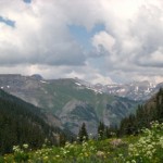 For the first day of the trip, we decided to do Alpine Loop, which is rated a 3-4 (out of 10) in difficulty, and is quite long. There were a total of 8 rigs in our group and we were the last group to leave that morning. The Alpine Loop (which consists of Engineer & CinnamonPasses) is truly amazing. The first few miles of the Engineer Pass trail are the most difficult and give this trail it's rating of a 4, so this area can be challenging for those new to off roading. After cresting Engineer Pass, the trail is easier and the pace picked up some. Near the top of the pass there is a great pull off that's an overlook of the entire range. At over 13,000 feet, this spot is one of the most amazing views you'll find in the Rocky Mountains. Be careful though: the altitude can really start to have negative effects for those not used to it. Cinnamon Pass is a much easier ride than Engineer; we saw quite a few passenger cars & mini-vans on this leg. The summit is over 12,000 feet and nearly as impressive as Engineer. Although the Alpine Loop is extremely long, it's well worth the time you'll spend.
Imogene Pass
On Saturday morning, we headed out at about 9am with a group of 8. Destination: Imogene Pass. After the quick drive up toward Yankee Boy Basin, we made the left onto the Imogene Pass trail. We were immediately greeted with an optional water crossing. We plowed through 24" of water without skipping a beat. The first half of Imogene was a BLAST! There were plenty of decent rocks, water crossings, and puddles to keep us entertained. The views were magnificent as well, this area of Colorado almost cannot be described. Due to Kent's unfortunate issues with altitude, I was asked to drive his truck down to Telluride so we could get him to medical attention. We moved down the mountain pretty quickly, so we didn't get many photos of our descent. We arrived in Telluride a little after 3pm where Kent got treatment for his altitude problems. He was feeling much better by the next day.
Last Day In Ouray
At about 9am, we arrived at the parking lot where a group photo was planned. We ended up in the 3rd to last row, so our FJ didn't stand out much in the crowd. Still it was a very cool experience. Almost 200 FJ Cruiser's in one photo – very neat. The photo came out pretty good I think. We invited Stan & Mike to run with us up to Yankee Boy Basin, since we didn't make it up the day before. It turned out to be not that exciting, mostly because of the crowd of people all around. There were rental Jeeps, Subarus, and other all wheel drive vehicles everywhere. Everyone was busy snapping as many tourist photos as they could. That kind of crowd can make the scenery not so scenic.  So, since we didn't spend any time at Yankee Boy, we decided to hit the first half of Imogene again. With the water crossings, water falls, and fun rocks, we wanted to make sure Stan & Mike got the chance to check it out. We made it up to the cabin area of Imogene pretty quickly, got a group photo, and headed back down to Ouray. It was lunch time, so we strolled down main street in Ouray & ended up at the Gold Belt Bar & Grill for a quick bite. We all ordered & decided to eat outside since it was such a wonderful day. The food was decent, and a reasonable price. Not fine dining, but a good quick lunch. After lunch we aired up & headed north out of town.
A Great Time
The First Annual FJ Summit was a HUGE success. Everyone had a great time and our outstanding Toyota FJ Cruisers got a good workout. Ouray, Colorado is one of the most scenic and adventure-filled towns in the Western U.S. If you've been there: GO BACK, if you haven't: MAKE PLANS. Keep in mind that the summer is a very busy time of year, so make your travel plans far in advance. Also remember that in addition to the FJ Summit, there are Jeep Jamborees and several other large events held in Ouray every year. You'll want to know what's happening in Ouray during your visit. Check the Ouray Event Calendarto find out more.
While our trip focused on off-roading, there are plenty of other activities including Hiking, Mountain Biking, and Mine Tours. In the winter months, you can observe or try out the world famous Ouray Ice Climbing Park, or head up into the mountains on cross-country skis or snowshoes.
Where to stay?
When we’re in Ouray, we always stay at the Box Canyon Lodge. They have fair rates, clean rooms, and excellent service. We also really enjoy their 2-4 person authentic wood barrel hot springs. If rooms are not available at the Box Canyon, there are plenty of other hotels available.
Outfitters
If you don’t own a 4wd vehicle, you can still experience the off road trails in the Ouray area. There are several Jeep Rental services. We recommend Switzerland of America Jeep Rentals. They have excellent service, very good vehicles, and reasonable rates. If you’re not inclined to drive a 4x4, consider taking an off-road tour.

